Why the Kickapoo River Valley’s Biggest Problem — Floods — Became Its Greatest Asset
Here’s the blunt truth: the river won. And that turned out to be the Kickapoo river valley’s competitive advantage.
Not in a fairytale way. In the everyday, get-it-done way. Repeated floods forced neighbors to collaborate, town boards to change the playbook, and farmers to redesign how they work the land. What looked like a curse became the Kickapoo River Valley’s edge — a model for places that can’t outmuscle water and shouldn’t try.
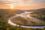
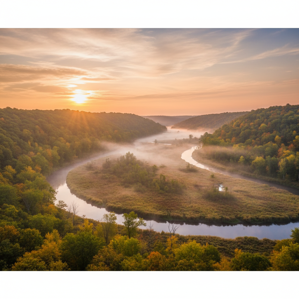
If you’ve seen the jaw-dropping photos of the Kickapoo River Valley’s misty ridges and meandering river, you know it’s gorgeous. Spend a weekend here and you’ll notice something deeper: the river is still the boss — and somehow, that works for the people who call this place home.
The Flood That Rewired the Kickapoo River Valley
The pivot didn’t happen overnight. The old strategy was predictable: build higher walls, dredge deeper channels, hope for the best. It failed. After one flood too many, a new message stuck — stop fighting the river; design with it.
Then came the buyouts. Tough, unglamorous, necessary. Families accepted offers to move from the most flood-prone blocks. Crews pulled up roads that washed out every spring. In place of asphalt and basements, the river got what it knows how to use: room.
Reconnected floodplains replaced doomed cul-de-sacs. Wetlands — nature’s spillways — spread across the low ground. Now, when the Kickapoo spills its banks, it slows down. Water parks on purpose. What looked like a loss of property became green space: ball fields that double as flood storage, trails that vanish and reappear with the seasons, canoe launches that bring life back to the river’s edge. Insurance bills even eased as risk maps caught up with reality.
Here’s the twist: small towns moved faster. Without miles of bureaucracy, local boards teamed with conservation groups and state partners to try practical ideas — like turning a former trailer court into a wet meadow that swallows spring floods. This wasn’t ideology; it was survival with a side of creativity.
Skeptics worried about the tax base and the loss of riverfront porches. Those were real costs. But the long game worked: fewer disaster checks, fewer emergency road crews, more visitors with kayaks, and more kids at summer nature camps. The investment bought safety, sanity, and a river that behaves like a river again.
How Farmers Turned the Valley Into a Climate-Resilient Breadbasket
Ask around and you’ll hear this: “We didn’t quit. We changed the plan.” Barns moved uphill. Generators went on platforms. Sheds came off the bend that always blows out. Yields didn’t collapse. Instead, a new farm economy took shape.
Flood-tolerant rotations emerged — small grains and forage along the bottoms, long-season crops on the benches. Pastures returned to places where water likes to wander. River margins, once weedy, thickened with native grasses and shrubs.
Regenerative tools doubled as flood tools. Buffer strips trap sediment before it clogs the river. No-till keeps soil from washing away. Cover crops weave a safety net below ground. As one farmer put it at a co-op coffee klatch: “I got tired of watching my topsoil leave the county.” Now, when water drops, fields are still there — and often richer for the silt it left behind.
New income streams followed. Wetland restorations created credits and partnerships. Canoe outfitters teamed with farms for “paddle-and-pasture” days. Specialty crops — maple syrup in shaded draws, cold-hardy greens in the shoulder seasons — tapped the valley’s microclimates. Visitors come for the beauty — just scroll that viral image thread — and stay because the place works.
This didn’t happen in a vacuum. Extension agents hosted barn-side workshops. Neighbors swapped seed mixes and timing tips. Apprenticeships grew into “learn my river, learn my ridge” mentorships. What took years to prove on one farm hopped fences and became normal down the road.
This is more than a local win. It’s a test case for farm country everywhere. If you can make a living where the river redraws the map every other year, you can make a living in a world of heavier rains and “hundred-year” floods that arrive twice a decade. The Kickapoo River Valley didn’t just adapt; it made climate resilience pay.
The Science of Letting Rivers Be Rivers
Here’s the hopeful truth: floods are brutal on houses and restorative for ecosystems. When a river jumps its banks, it spreads a thin layer of silt across the floodplain. That’s a mess for a living room but gold for a prairie. Over time, the lowlands become a pantry for the entire watershed.
Letting the river meander again — with oxbows, side channels, and backwaters — multiplies habitats. Rare plants slip back into wet edges. Birds find new rest stops on migration. Fish return to slow-water nurseries tucked behind willow thickets and inside crescent ponds where the main channel once ran.
Call it living infrastructure. Wetlands and floodplains shave the top off flood peaks, soak water into aquifers, and lock carbon in peaty soils. They’re cheaper than concrete and a lot better looking on a Saturday morning paddle. And when a monster storm outgrows them — as storms sometimes will — those green spaces take the hit, not your main street.
How did locals decide where to give the river space? Part tech, part gut. Simple hydrology models and flood maps flagged hot spots. Citizen scientists walked banks, logged high-water marks, and phoned in logjams before they became dams. Over time, data and memory aligned. The river left breadcrumbs. People followed them.
The metric shifted, too. Success used to be measured in inches — how high a berm, how deep a ditch. Now it’s acres — how much functional floodplain, how many connected wetlands, how many miles of river with room to breathe. Control gave way to resilience. That’s not semantics. It’s a different way of doing life with water.
Your Low-Impact Weekend: The Anti‑Tourist Guide to the Kickapoo River Valley
You don’t need a five‑star lodge to meet the Kickapoo at its best. You need a canoe, a quiet bend, and respect for the locals who made space for the river so you could experience it.
- Skip the crowded trailheads. Paddle hidden oxbows early or late, when daylight turns the bluffs copper. Book with local outfitters who reinvest in river restoration. Ask which launches see less traffic — they’ll tell you.
- Sleep on a farm. Many operations offer simple stays and hands‑on workshops. Spend a morning planting a riparian buffer or learning why a cereal‑rye cover crop smells like fresh bread after rain. You’ll leave with dirt under your nails and a deeper sense of a working landscape.
- Eat like you mean it. Valley breweries pair small‑batch ales with vegetables grown within a bike ride. Seasonal farm dinners pop up in barns and under string lights beside creeks. And yes, the trout is excellent — cold springs and clean gravel beds make for delicate filets that travel about five miles from stream to plate.
- Be a guest, not a burden. Park where signs say. Pack out stray flood junk you find in branches. Visit midweek if you can; it spreads out pressure on small towns. The place looks like a postcard — check the photos everyone shares — but people live and work in Kickapoo river valley all year‑round.
- Pitch in. Join a weekend river cleanup. Tag along on a citizen‑monitoring run with a local naturalist group. Some outings double as fundraisers for floodplain projects — your paddle can help build the next wetland that protects a neighbor’s basement.
What the Rest of America Can Steal from the Kickapoo River Valley
Adaptation isn’t surrender. Done right, it’s leadership. Here’s what travels well to any place staring down water it can’t bully:
- Targeted buyouts and floodplain easements. Spend once to move people out of harm’s way, then let that land do flood work forever.
- Incentives that reward resilience. Pay farmers for buffers, wetlands, and soil that stays put. Reward outcomes, not just intentions.
- Small pilots, fast feedback. Test a modest wetland here, a setback there. Learn quickly, then scale without red‑tape drag.
- Track the right wins. Fewer disaster declarations. Healthier fisheries. More climate‑ready farms. And a new local story: not “we barely survived,” but “we figured it out.” That narrative attracts visitors, entrepreneurs, and the kids who might have left but now see a future at home.
- Fund local leadership. Rural places aren’t just climate victims; they’re idea labs. Give them flexible dollars and trust. They’ll return something more valuable than a ribbon cutting: a playbook anyone can use the next time the water rises.
Stand on a bluff at sunrise and the plan snaps into focus. The river snakes. Fog lifts. Farms stitch the hills. Towns hug the dry ground — not because they had to be perfect, but because they chose to be honest about risk and generous with space. The Kickapoo didn’t stop flooding. People started listening. That’s the real comeback story — the one behind the pretty picture you saw online and the paddler you’ll pass on a quiet bend who smiles because this place belongs to the river and the people, together.
For more on Travel & Food, check out our other stories.